Côte de Saint-Léger-les-Mélèzes
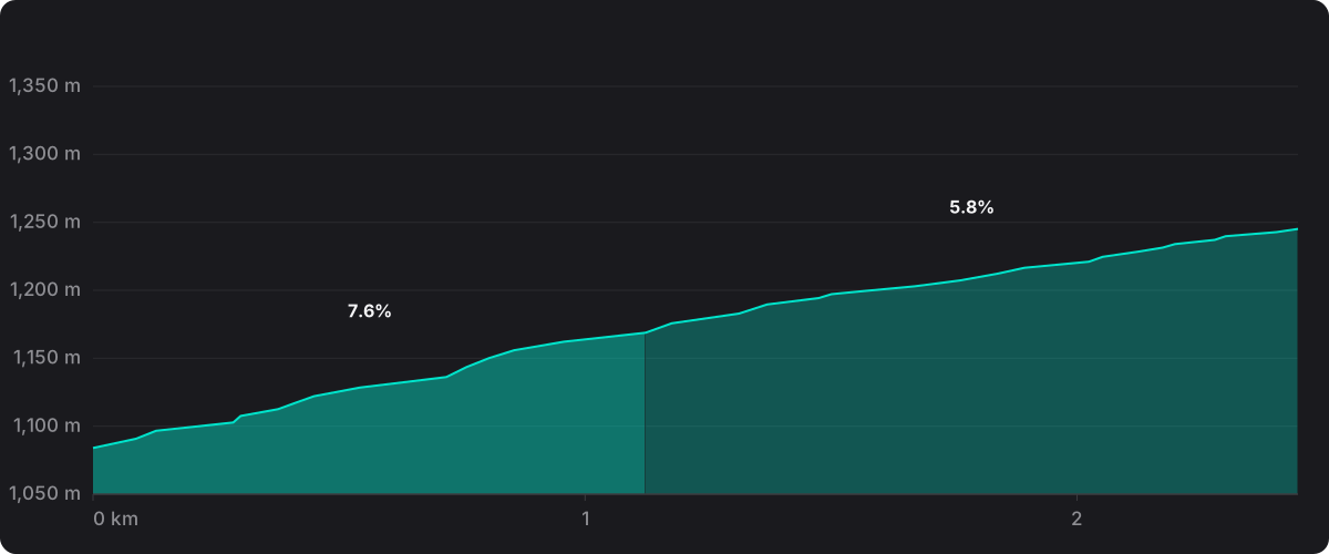
2.5 km at 6.9%, summit at 1,237 m. Cat 3.
- Length
- 2.5 km
- Average gradient
- 6.9%
- Height gained
- 172 m
- Summit
- 1,237 m
- Steepest km
- 7.8% measured on the route
- Category
- Cat 3
The climb
Côte de Saint-Léger-les-Mélèzes climbs 2.5 km at an average of 6.9%, gaining 172 m to a summit at 1,237 m. The gradient barely moves: kilometre after kilometre sits within a point of that average, so the figure describes the whole climb rather than smoothing anything out.
The hardest kilometre measures 7.6% and comes in the opening third of the climb.
In ProPace's stage data it appears on the single stage listed below.
Stages that climbed it
| Stage | Date | Summit at | Category |
|---|---|---|---|
| Tour de France 2026, stage 18: Voiron → Orcières-Merlette | 23 July 2026 | km 166.9 | Cat 3 |
Stages since 2024 whose route climbed to this summit, matched on ProPace's route data. Category as listed for that stage where the roadbook data is in the app.
In ProPace you ride the whole stage, this climb included, against a pro reference in the real wind from the day. How the simulation works is set out in How much slower than a pro are you?
Ride the stages over Côte de Saint-Léger-les-Mélèzes against a pro in ProPace. Free on iOS.
